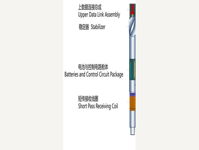
CGDS NB near-bit geosteering: instrumented motor, wireless receiver and positive-pulse MWD that steer the bit using geology measured at the bit.
The four subsystems are quoted as one system, because the value is in the data path between them rather than in any single tool.
Figures taken from the CGDS Near-Bit Geosteering Systems data sheet issued by BOMCO. Values are nominal and the quotation confirms the build for your order.
Geosteering only works if the measurement is taken close enough to the bit to change the next metre rather than the last one. CGDS NB puts the geological sensors into the motor assembly, receives the data through a short wireless hop, and sends it to surface over a positive-pulse MWD link so the directional driller sees formation and toolface together.
The system is built from four parts that were designed as a set: the instrumented motor, the wireless receiver, the MWD pulser and the surface software that turns the readings into a steering decision.
We hand over the system with the configuration record, so a replacement sub is fitted without a new data model on surface. Our engineers sit with the operator's geologist through the first wells, and we tune the steering workflow to the reservoir rather than to the factory default. Steering a thin reservoir on MWD readings alone is what we would argue against, and we say that at the planning stage. Bring us the well plan and the steering workflow is returned mapped to it. Our engineers stay through the first wells, and we tune the workflow as the reservoir answers back.
Because the sensors at the bit see the formation before the string has drilled through it. On a thin reservoir that is the difference between staying inside the pay zone and finding out one stand too late.
Yes. That is the specific question the near-bit measurement answers, and it decides whether the correction is a build or a drop. The oil, gas and water contacts are resolved at the same time.
CFDS puts the near-bit reading, the directional survey and the well plan on one screen, so the steering instruction is formed from the data rather than from a phone call between the geologist and the driller.
The system was awarded the National Technology Invention Award, second class, in 2009, and it is listed as a nationally independent-innovation product.
Motor, receiver, MWD and software are supplied with the same configuration record, so a replacement sub does not need a new data model on surface.
The geosteering system runs with a near bit geosteering tool in the string, so the measurement is taken where the bit is cutting rather than a stand behind it.